Archive for the ‘Environment’ Category

Still Snowing!

Wednesday, April 17th, 2013

It started to snow a few days ago…

And it’s still coming down. Duncan Madog is having fun at least.

This morning the pile on the deck bench was 14 inches high.

No school today, maybe no school tomorrow either. The good part: Some ski lifts may open for extended Spring skiing and maybe, just maybe the mountain snow pack will be near normal conditions.

What will they think of next?

Wednesday, February 27th, 2013

A mystery next door:

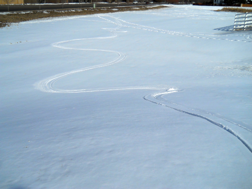
Strange ski tracks in the snow

What the heck is this? While out walking Duncan Madog, we came across these tracks that look like they were made by skis. The tracks seem to make graceful curves in the snow with the pair of skis seeming to remain parallel about 20 inches apart.

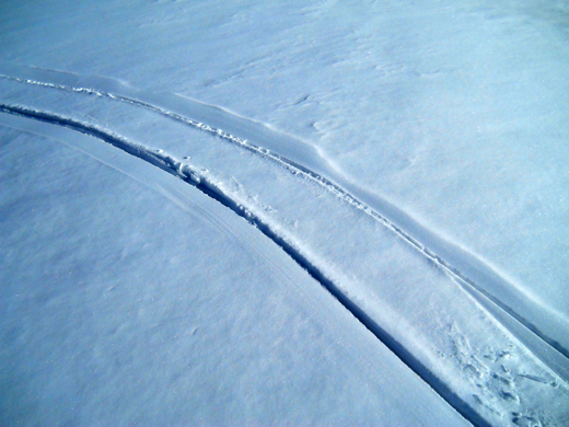
A closer look at the tracks

It appears that the only markings in the snow are caused by two skis. There is no evidence of a track as on a snowmobile or pole plants as on cross country skis. What could have made these tracks?

Answer: The Goosinator!

The maintenance department at FRCC have finally found something useful to do besides maliciously destroying neighborhood property: The are using a ‘drone’ to scare away the geese! Yes, there is a company in Denver that developed this remote controlled wingless ‘ski-plane’  to chase away geese off your property. The company calls it “The Goosinator”.  Apparently you have someone “fly” this thing after the geese a few times and then set up a few “decoy” orange painted toothy yellow-eyed goosinator impostors around the yard and the geese won’t land there again.  Or poop there again, which I would assume is the main reason for scaring away the geese. The goosinator website says they cost about $3500.oo which is cheap based on their cost analysis of goose damage to golf courses.

But the FRCC is no golf course, so the justification for this expense seems kind of flaky. Being that the  FRCC is the Front Range Community College, it might have made better sense to have had some of the tech students work with the construction and art students to build their own goosenator or perhaps have a few teams build a few of them and have goose chasing competitions. I also think the students could build something like the device pictured above for about $500. They might even learn something in the process.

National Day of Service

Sunday, January 20th, 2013

Love Liberty?

Costumed wavers on Harmony

It’s that time of year again to be distracted by this tax preparation company and their team of costumed wavers dressed as the replica of the Statue of Liberty from the New York, New York hotel and casino in Las Vegas. I think.

Trash pick up on Poudre

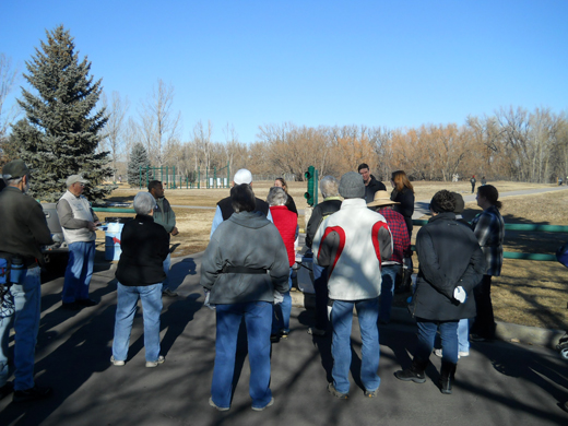
As part of the National Day of Service we picked up trash along the Poudre River. The major finds were located near transient camps under railroad bridges and consisted of beer cans, bottles, food containers and paper products. There was an old tire on the banks of the river but it was too frozen-in to remove.

Seen on route

Sunday, July 15th, 2012

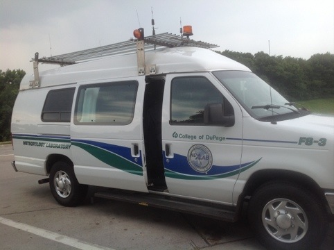
College of DuPage has a van?
20120715-154412.jpg
One of the NexLab vans
Actually there were two vans on the road going out to the Dakotas to try and find some severe weather. You can track them online HERE to see where they are.

Look who’s kicking America’s ass:

20120715-154430.jpg
Another group on a mission
They are on a mission to make 50 movies in 50 states in 50 days. Check HERE for details.

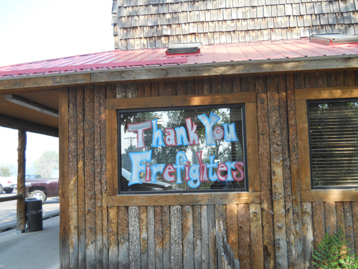
THANK YOU FIRE FIGHTERS

Thursday, June 21st, 2012

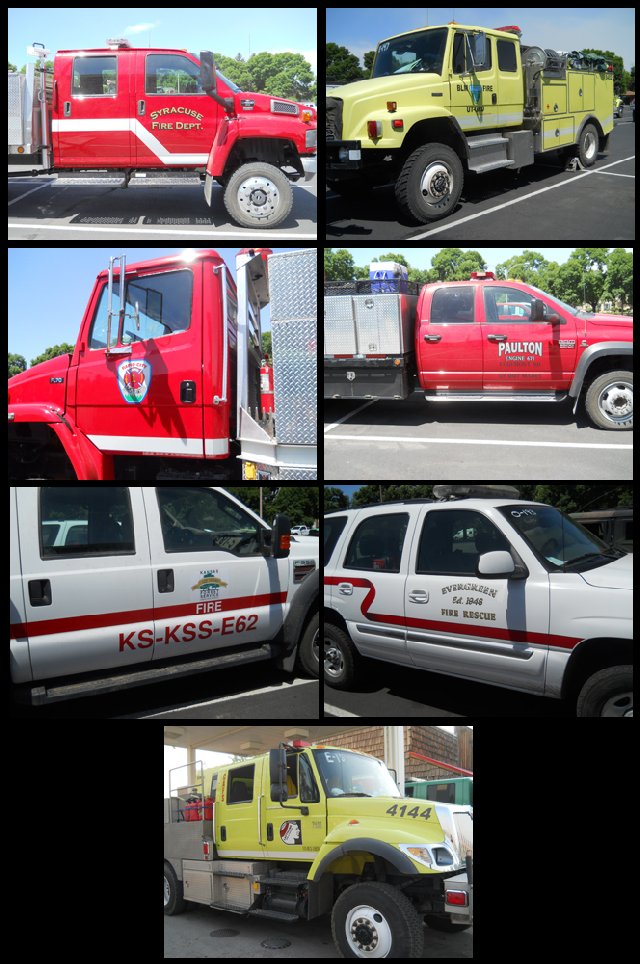
Hey, I found a few trucks:

Fire fighters from Lakewood, Co, The Colorado National Guard, U.S. Forest Service, U.S. Department of Agriculture, Great Northern Fire, Eagle CO. F.D., Sunfire from Keystone, SD., Basalt Fire & Rescue, Syracuse UT FD, BLM Fire, Rapid City SD FD, Edgemont SD FD, Kansas Fire Service, and last but not least, the Left Hand Fire & Rescue. To you and all the others I didn’t see today, THANKS FOR BEING HERE!

NoCo Water

Tuesday, June 19th, 2012

Celebrating it’s 75th year:
Now located in Berthoud, Colorado

I think I’ve mentioned before that water is an important topic in Northern Colorado. And if you need to learn as much as you can about what’s going on with our water (us being Northern Coloradoans) you can get on the waiting list to attend a NCWCD tour. Once you are on the guest list, you can get on over to Berthoud, Co. (Remember Berthoud?) and get on the bus to either the east or west slope tours.
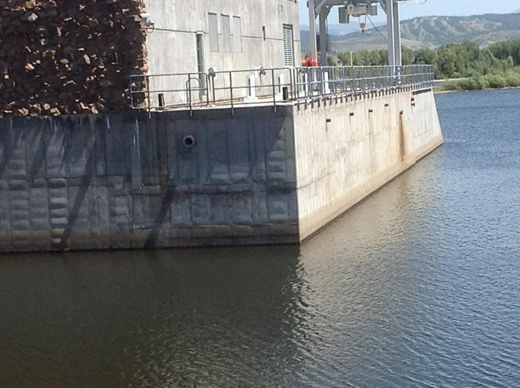
Windy Gap blow holes

The pumping station at Windy Gap pushes tons of water up-hill in an eastern direction towardLake Granby with the intention to control the water level of the lake: It is not to change by more than 12 inches! If something happens to the pumps that would make them stop, tons of water flow back to the station and shoot out of the blow holes.
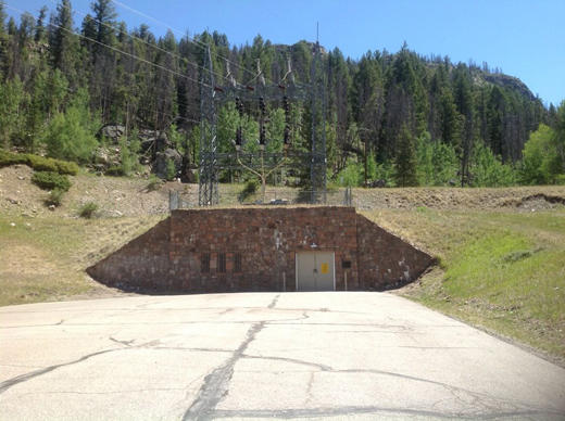
Not an ICBM bunker

It’s a tunnel that goes under Rocky Mountain National Park
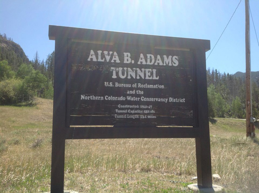
The Alva B. Adams Tunnel, specifically

One of many tunnels in the “System”, the system being the Colorado-Big Thompson Water Project (aka, the C-BT) , but this one is the largest water tunnel, 13.1 miles long, 9.75 feet in diameter, drops 109 feet end to end (How did they do that?) it takes the water from Grand Lake on the east on the mountains and delivers it at 5 miles per hour to Mary’s Lake on the east side of the mountains.
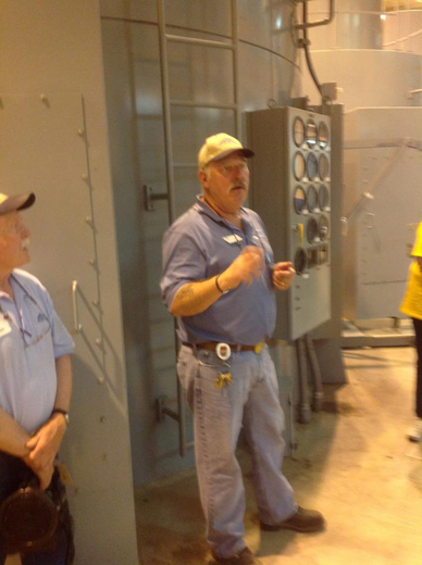
Pumping station talk

Among other talks on the tour– Oh, about the tour: This was the West Slope Tour: it was free, and it included a continental breakfast and lunch and a bus ride through Rocky Mountain National Park and back; Total time on tour: 10 hours!
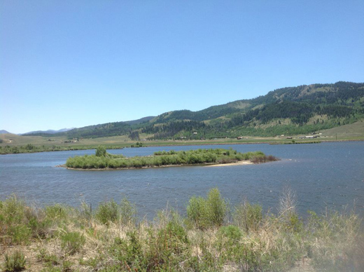
Windy Gap Reservoir bird island

This was a very environmentally friendly area and it was great for viewing the local wildlife. Of course there are many more reservoirs in the chain of the C-BT, let’s see: Our water comes from Green Mountain to Windy Gap to Lake Granby to Shadow Mountain to Grand Lake to Mary’s Lake to Lake Estes to Pinewood to Flatiron and finally Horsetooth.
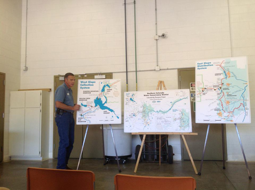
Eric tells us how

Eric is one of the plant engineers at the C-BT and he gave us even more information about Colorado water than the engineer on the 2 hour bus ride up to Windy Gap. Really it’s information overload unless you are a water engineer or something like that.

It’s WAR

Sunday, June 17th, 2012

The High Park fire is now the largest wild fire on record in Colorado:

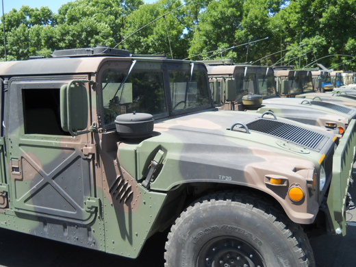
The National Guard has their HUMVEE’s ready to go

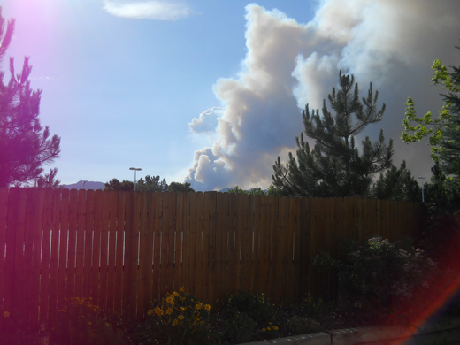
View from the back yard

Earlier today it was relatively clear in the foothills but later today the winds changed and now smoke and ash is blowing into Old Town Fort Collins.

At Vern’s in LaPorte

The firefighters’ number one priority is to keep the fire from spreading to populated areas. They are doing what they can, but today’s winds are making it difficult.

Bingham Hill Park

Wednesday, June 13th, 2012

Remember “Payton’s Hill” in Arlington Heights, Illinois?

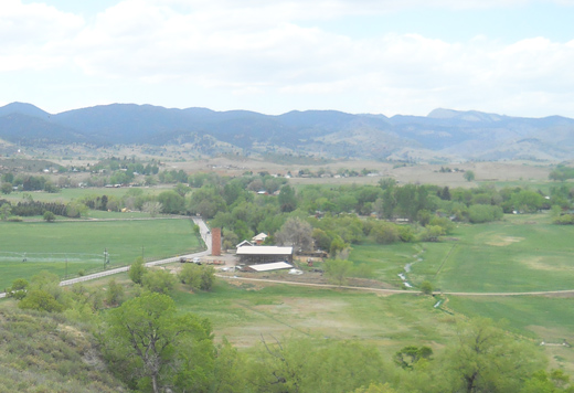
This is the view from “Bingham Hill Park” looking westward

I was biking up Bingham Hill a few weeks ago in preparation for the preparation of that big bike ride across Iowa, whatever it’s called… Rag– something or other. In this picture there is a farm house  and above it in the background are the foothills of the Roosevelt National Forest.

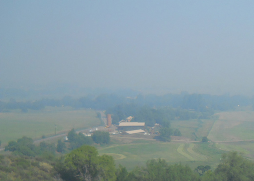
The same view today

The smoke from the High Park Fire has taken away the foothills for the moment. Uncertain winds will change this scene more than a dozen times in a day and there are hopes that the fire does not spread eastward. Since last reported on June 9th, the size of this fire has increased an order of magnitude.  The type I fire crews have control of 10% of the fire as of today. Note: Type I fire crews function as the “initial attack” on a forest fire while the type II crews carry out suppression efforts and mop-up activity.

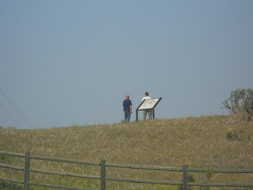
Bingham Hill area residents on the hill

I watched as several people over an hour’s time walk up to the top and look over the valley in the direction of the fire. The home-owners are a bit edgy as they know that conditions could change rapidly and the fire could spread into the valley. Less than a mile west of the  hill is the road leading to Lory State Park; the road is blocked by Colorado National Guard vehicles and so is Rist Canyon Road near the town of Bellvue.

We will be glad to hear on the news when the Type II fire crews are in place. Soon I hope…

High Park on Fire

Saturday, June 9th, 2012

The view west from our deck:

Near Rist Canyon

At the time this picture was taken at noon today, it was a 200 acre fire. By 7:30 p.m. it increased to 5000 acres. It looked like the Horsetooth Reservoir was on fire this morning but in reality the High Park area is about 25 miles from here.  What a start to the Summer, two days ago it was the Camman fire, then Stuart Hole fire,  and  last month the Hewlett fire.

The Bus 2 Pingree

Wednesday, September 21st, 2011

It’s near where we went in 2008 on the Veteran’s Day Trek.

No hike today: We went via a CSU Bus

to the beautiful Pingree Park Conference area and learning center for CSU’s forestry students. We didn’t hike up to the B17 crash site this time; We just took a tour of the many buildings at the park and took in the fall colors.

A member of the Warnar College of Natural Resources

tells us how we could become involved in the many activities at the “mountain campus”, including music and painting workshops not to mention getting lost on the miles and miles of hiking trails.

Taxidermy in the museum

among other things. I haven’t posted a picture of a stuffed cat in a while, so here it is.

The Cold Storage

is one of the buildings on this site. George Pingree first came here to cut down trees for making railroad ties in 1868 then the Ramsey and Konig families homesteaded the area and built a number of log structures.

Kiddie cemetary

Some of the Konig kids didn’t make it through the harsh winters here. They were buried in the plot with lamb markers (now placed upon cinder blocks for easier viewing).

The Colors!

The park is a little over 9,000 feet in elevation so we were able to catch an early glimpse of what to expect down below in FoCo in the next week or so.